
Go to the TCRS General Info Page for rules, cost and contacts.
Click the race name for the full description
Click on the results link to get the results for a specific race.
| TCRS | Date | Day | Time | Location | Length |
| 1 | 19-Jan | Sun | 9:00A | Tennessee Valley - RESULTS | 3.78 Mi |
| 2 | 23-Feb | Sun | 9:00A | St. Vincent's School - RESULTS | 4.9 Mi |
| 3 | 9-Mar | Sun | 9:00A | Oakwood Valley - RESULTS | 4 Mi |
| 4 | 6-Apr | Sun | 9:00A | Indian Valley - RESULTS | 5.5 Mi |
| 5 | 4-May | Sun | 9:00A | Northridge - RESULTS | ? Mi |
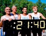
| 6 | 11-Jul | Fri | 7:00P | Marin Headlands - RESULTS | 5.5 Mi |
| 7 | 10-Aug | Sat | 9:00A | Miwok Heights - RESULTS | 6 Mi |
| 8 | 14-Sep | Sun | 9:00A | Crown Road - RESULTS | 3.1 Mi |
| 9 | 26-Oct | Sun | 9:00A | Sam Taylor - RESULTS | 10 K |
| 10 | 16-Nov | Sun | 9:00A | Redwood High School - RESULTS | 5 K |
3.78 Mi - Out and back hilly course starting at Tennessee Valley horse stables. Heads west on a downhill grade toward Tennessee Cove at the beach. First and last 3/4 mile is paved and the remainder is dirt fire road. If rainy, mud adds new dimension to race. Usually has large turnout with as many as 190 runners competing in the kickoff race of the year.
Directions - From Highway 101 near Mill Valley take Hwy. 1/Shoreline offramp toward Mill Valley and Stinson Beach. Approximately 1/3 mile from freeway, turn west on Tennessee Valley Road. Follow about 2 miles to end and park.
4.9 Mi - Out and back, flat course with loop in the middle. Starts in parking area just east of freeway on paved road for first and last 3/4 mile. Remainder of course is on dirt road levies next to the bay and ponds.
Directions - From Highway 101 north of San Rafael in Marinwood, take St. Vincents Drive offramp. Go east 1/4 mile to parking area.
5.15Mi - Race sign-up at Tamalpais Improvement Club, 203 Marin Avenue (faces Tennessee Valley Road), Mill Valley. Jog to start at Oakwood Valley trailhead. The course goes up Oakwood Valley to the top, takes a left at the top of the hill. Run down to gate near freeway, touch the gate at the end of the trail and return via Milano fire road.
Directions - Take Stinson Beach exit from 101 and turn left on Tennessee Valley Road. Turn right on Marin Avenue and pull into parking lot on left.
The course is flat, rolling and hilly. About 5.5 miles.
The rolling and hilly parts go both up and down. The flat sections go neither up nor down. The net elevation gain is exactly zero! Therefore it can't be a very difficult course. The distance has been estimated at 5.5 miles by those who want to induce under-trained runners to participate. Because Russ has yet to drive his station wagon over the course, it hasn't been measure or certified. Jack Burns will no doubt give us a GPS measurement down to the last silly millimeter. If you love the Dipsea, you'll like the Indian Valley course. If you hate the Dipsea, you belong to the wrong running club.
Directions: The race will start and end near the baseball field on the campus of Indian Valley College. The college is located at the end of Ignacio Boulevard (about two miles west of Highway 101) in Novato.
Driving directions: From East Blithedale Avenue in Mill Valley, turn north on Camino Alto, take a left on Overhill Drive (at the large Northridge sign), park near the intersection of Overhill and Escalon.
Course description: This is a 6.8 mile run on very hilly fire roads.
Runners should carry water. From the starting point on the Overhill Drive
fire road, the course is flat for about 600 yards to the intersection known
as the Octopus. The course then takes the steepest option at that
intersection, the Blithedale Ridge fire road. The course follows the fire
road until it intersects Summit Drive in Corte Madera, where the course goes
up Summit to reconnect with the Blithedale Ridge fire road. After staying
on the fire road through the intersection with Huckleberry Trail and Warner
Canyon fire road, the course takes the next left turn at Judy's Corner to go
down the fire road to Via Van Dyke Avenue in Mill Valley (this is the same
fire road that we run up in Roger's Super Bowl Run). Via Van Dyke ends at
Elinor Avenue, where the course makes a hairpin turn to the left on Elinor.
Within a few hundred yards, Elinor turns into a fire road (the one we come
down in the Super Bowl Run). We follow that fire road to its intersection
with the Warner Canyon fire road, where we make another hairpin turn to the
left. After climbing up to the Blithedale Ridge fire road, the course turns
right and returns to the starting line.
If this sounds impossible to follow, don't take the lead.
Details to follow.
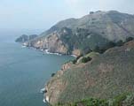
The start and finish on Miwok Fire Road south of Shoreline Highway. Out-and-back, approximately 6 miles, all fire road, mostly very gradual up and down. No parking on Shoreline Highway; you must park on Panoramic Highway, north of Diaz Ridge trailhead. Registration will be at Diaz trailhead; we will jog about 3/4-mile to start and finish area. Take Highway 101 to Stinson Beach exit, then Highway One to intersection of Shoreline/ Panoramic Highways. North on Panoramic, Diaz trailhead is on left shortly after intersection. Ample parking on Panoramic.
Start at Crown Road trailhead. Course will be what is
known as the Crown Road Up-and-Over Course (approx 5 miles.) Flat fire road
to pump house, up and over ridge to beginning of Railroad Grade on Mill
Valley side, loop back up and over to pump house, and return to start. All
fire road, evenly divided between flat, steep uphill, and steep downhill.
Directions to Start: Enter Kent Woodlands across from the College of Marin on Woodland
Avenue, take second left on Evergreen, climb hill about one mile, turn
left on Crown Road, be sure to park on south side of street
10K - This is a flat, fast, paved course that runs on a walking/bike path in Samuel P. Taylor State Park off Sir Francis Drake not far past the town of Lagunitas. The course is a measured out and back 10K.
Directions: Take Sir Francis Drake Blvd off Highway 101 near Greenbrae/Larkspur and head west. Continue through San Anselmo and Fairfax approximately 12-15 miles to the entrance to the park on the left. Follow road through park and across Lagunitas Creek to back side of park area. Allow 45 minutes to get there from central Marin.
5K - Course starts and finishes in front of the gymnasium. The actual route is a mystery so it will be a suprise to all who don't join the practice run a week before. BUT... it is fast and flat, good news for those who feel like they've already gotten in their "hill quota" for the year.
Directions: Off Highway 101 south, take the Lucky Drive exit in Larkspur/Greenbrae and go west to Doherty Dr. Turn right on Doherty and follow curve around school, turning into front parking lot by the gym.
Heading north on 101, take the Lucky exit, right on Redwood Highway, right on Wornum, right on Tamal Vista, left on Lucky Drive. Follow to Doherty and continue as above. The address is 395 Doherty Dr.
If you're coming from Magnolia Street in Larkspur, turn onto Doherty Dr at the stop light and follow about a half-mile to the school
Tamalpa Gazettes
July 2016 Gazette
Older Issues
The Most Useful Links
Kees Training Blog
Frank's "Tamalpa This & That"
Tamalpa Talks
Five Most Recent posts from the Tamalpa Forum