
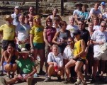
October 31, 2009
Due to California budget and staffing constraints The Tamalpa Challenge WILL NOT be held at China Camp State Park. We have arranged to hold the 2009 edition in Rodeo Valley in the Golden Gate National Recreation Area just north of the Golden Gate Bridge.
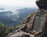
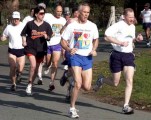
We have designed a 4.25 mile course that will be completely on fire roads with one graded raise of 400 feet in a mile. This is a spectacularly beautiful area and will be a great race.
Parking is extremely limited. Please carpool to the greatest extent possible. Almost all racers will have to park at the beach area parking lot, which is about 0.5 mile from the start. Again, please car pool.
Go north on highway 101. Take the Alexander Avenue exit (second exit after crossing the bridge, right after scenic overlook exit). Stay to the right on the exit ramp to get onto Alexander Ave. Turn left on Bunker Road (a brown sign saying “Marin Headlands Visitor Center” marks the intersection). Go through the one-way tunnel and drive approximately 2 miles.
(From Norhtern East Bay take 580 west to the Richmond/San Rafael bridge. Cross the bridge, toll this direction will cost $2, Take the second exit after the bridge, go through Larkspur and get on 101 south.) Follow 101 south through the Waldo tunnel. Take the last “Sausalito” just before the Golden Gate bridge. Turn right at the end of the exit ramp and Pass under 101, at the stop sign go straight onto Alexander Avenue. Turn left on Bunker Road (a brown sign saying “Marin Headlands Visitor Center” marks the intersection). Go through the one-way tunnel and drive approximately 2 miles.